Climate
For other uses, see Climate (disambiguation).
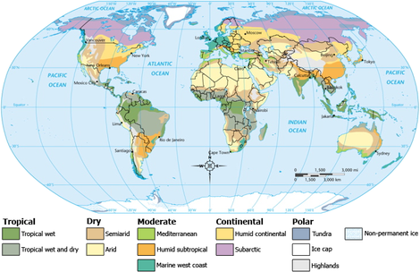
Climate encompasses the statistics of temperature, humidity, atmospheric pressure, wind, rainfall, atmospheric particle count and other meteorological elemental measurements in a given region over long periods. Climate can be contrasted to weather, which is the present condition of these elements and their variations over shorter periods.A region's climate is generated by the climate system, which has five components: Atmosphere, hydrosphere, cryosphere, land surface, and biosphere.[1]
The climate of a location is affected by its latitude, terrain, and altitude, as well as nearby water bodies and their currents. Climates can be classified according to the average and the typical ranges of different variables, most commonly temperature and precipitation. The most commonly used classification scheme was originally developed by Wladimir Köppen. The Thornthwaite system,[2] in use since 1948, incorporates evapotranspiration along with temperature and precipitation information and is used in studying animal species diversity and potential effects of climate changes. The Bergeron and Spatial Synoptic Classification systems focus on the origin of air masses that define the climate of a region.

No comments:
Post a Comment